
PulsePoint Respond
| Category | Price | Seller | Device |
|---|---|---|---|
| Medical | Free | PulsePoint Foundation | iPhone, iPad, iPod |
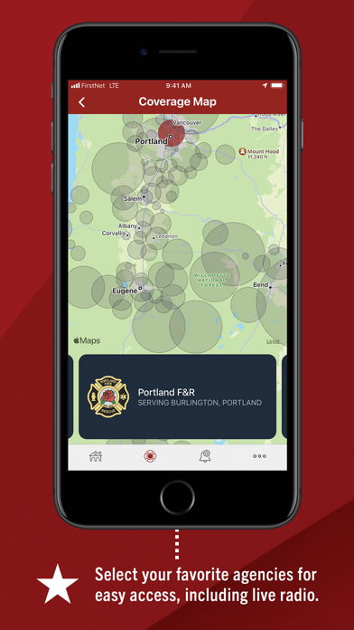
PulsePoint currently provides coverage for hundreds of cities and communities, with many more on the way.
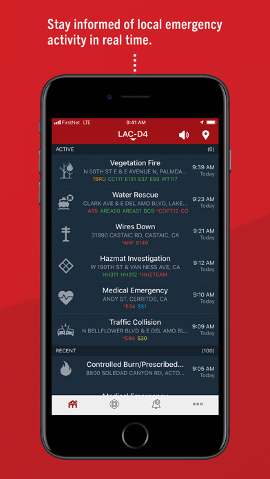
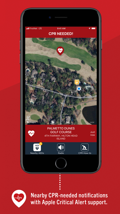
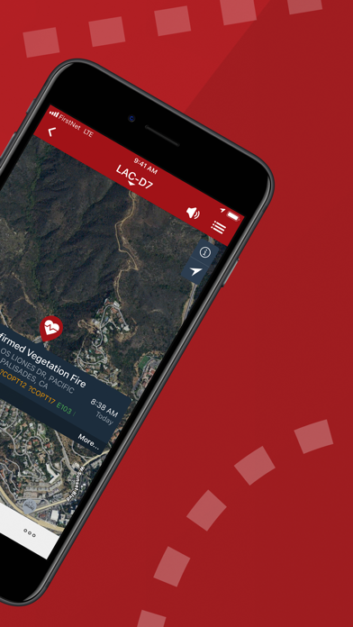
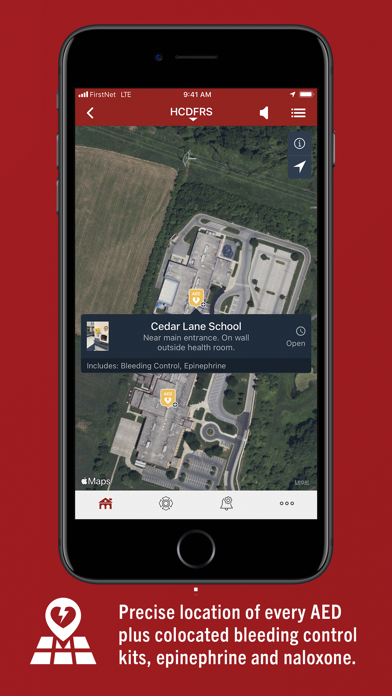
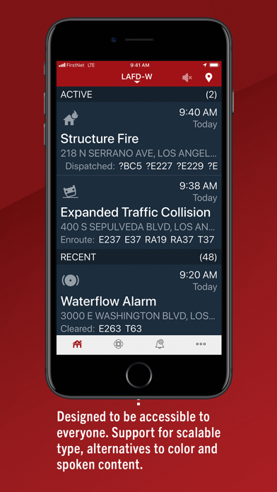
The PulsePoint app is a virtual window into these 911 communication centers and provides real-time access to emergency activity as it is occurring. Users can view incidents - including the current response status of dispatched units - and instantly pinpoint the location on an interactive map. Curious as to where that fire engine or ambulance that just passed is headed? Is there an accident up ahead causing this traffic tie-up? Just tap the application to quickly find the incident location or plan an alternate route.
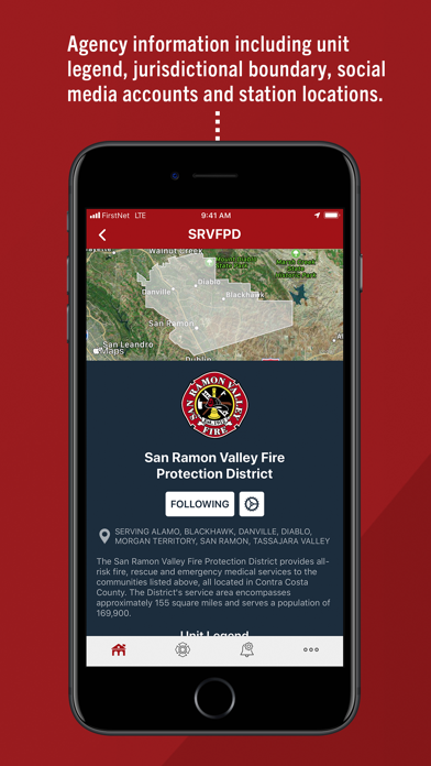
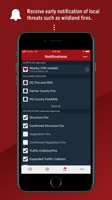
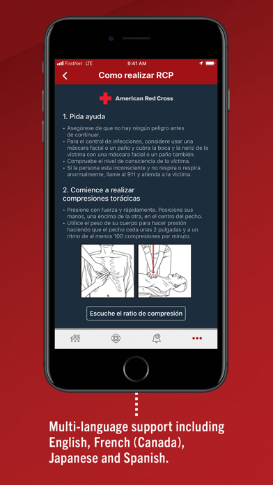
Additionally, users can choose to receive incident notifications when they are dispatched and listen in on live emergency radio traffic via this modern version of the traditional fire scanner. A photo gallery of significant events along with other agency images and information can also be easily accessed.
Would you like to see PulsePoint supported in your community? All that is required on the local level is the initiative to get started. Bring PulsePoint to the attention of your local fire department, city council, or emergency response agency and tell them you would like them to see PulsePoint helping to save lives in your community.
Original development of the PulsePoint app was the result of a successful partnership between the San Ramon Valley Fire Protection District (CA) and the College of Informatics at Northern Kentucky University in 2009. In 2011 the PulsePoint Foundation was formed “to share its life saving potential.” Today all engineering is provided by skilled volunteers from Workday, Inc.
For more information, visit our web site at www.pulsepoint.org or contact us at [email protected].
NOTE: Configuration of this app includes the capability for continuous GPS monitoring. Continued use of GPS running in the background can dramatically decrease battery life.
Reviews
Review of PulsePoint
Steve 91001
I found the software very useful in determining whether sirens mean fire or rescue since we live near the mountains in a canyon that has many rescues. I wish I could look at multiple agencies at one time, and use them near me geographically. As it is I have to switch between LA County district 3 and Pasadena to find out who has responded near my home. Otherwise I love the app.
Pulse point is helpful !
'Becca L
It’s nice to get these notifications because I’m very busy and constantly on the go. When time gets short and I receive a notification of an accident or emergency of some kind, I know to avoid that area and find another route. Saves me time and frustration.
I don’t get notifications
needraM
I have enabled all notifications in PulsePoint and my settings, yet I never see any alerts
Missing calls
office finatic
Three alarm fire in Pittsburg CA and there’s no information. Really bad. This was a lumberyard fire. Displaced many engine companies in the county. Need to step up your game.
PulsePoint on point
0116.fire.photography
Love this app, keeps me updated quickly and allows for me to be on scene capturing photos within minutes. Just wish I could listen to more tac channels on there but having the access it allows is perfect.
Great app
samson minytz
Are you guys planning on adding Santa Monica, Culver City, Beverly Hills, FDNY, or Chicago Fire dept in the future?
Nice
lzkitkat
The app is awesome only issue I have are certain things in red because I can’t see the status on scene!
SMH
Ninnymakemeadog
Uploaded the app. Was disappointed with the amount of areas not associated with the product. If you’re going to offer a product of this type, offer it to all agencies int the surrounding areas. If you can’t then don’t offer it at all. I’m letting this go.
Future update
edhead5561
Hello, I wanted to throw out an idea to enhance PulsePoint simply by adding details to the nature of the calls for instance instead of putting “Medical Emergency” maybe be more descriptive such as like “Injury ALS/BLS” or whatever the nature of the call is.