MarineTraffic - Ship Tracking
| Category | Price | Seller | Device |
|---|---|---|---|
| Travel | Free | MARINETRAFFIC APPLICATIONS LTD | iPhone, iPad, iPod |
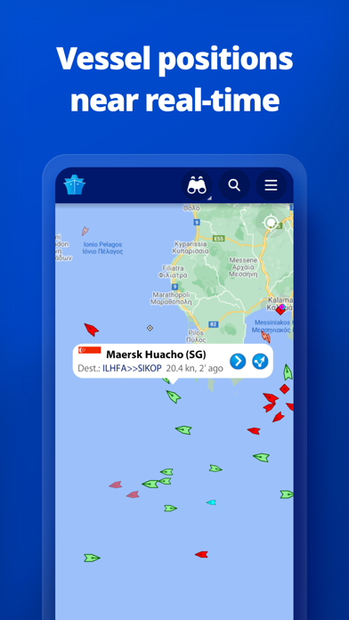
Connected to the largest network of AIS receivers, the app covers most major ports and shipping routes.
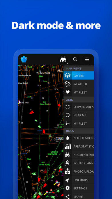
• View VESSELS ON THE LIVE MAP, search for ships, boats and seaports and see what's near you!
• More than 120,000 VESSELS PER DAY report their positions via MarineTraffic AIS
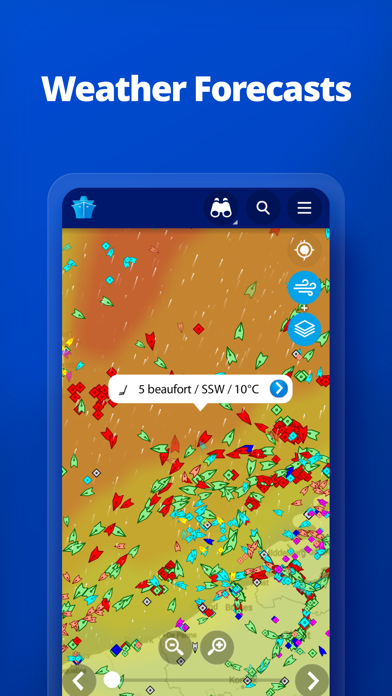
• View live wind and 48-hour WIND FORECASTS on the map
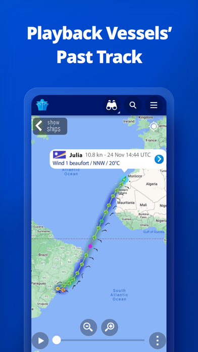
• ANIMATED PLAYBACK of vessel's track
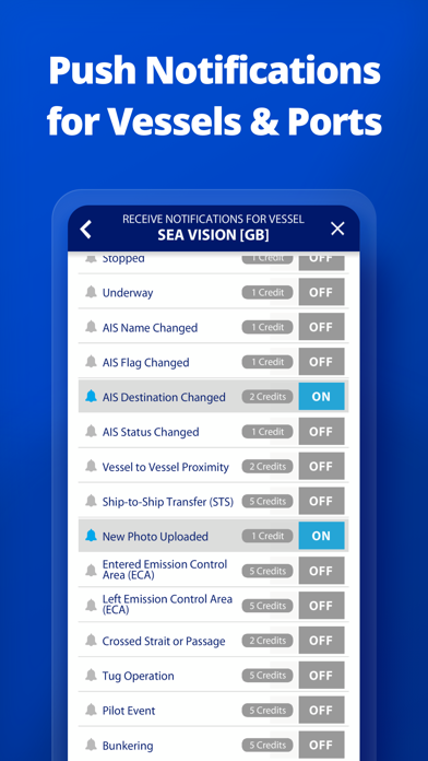
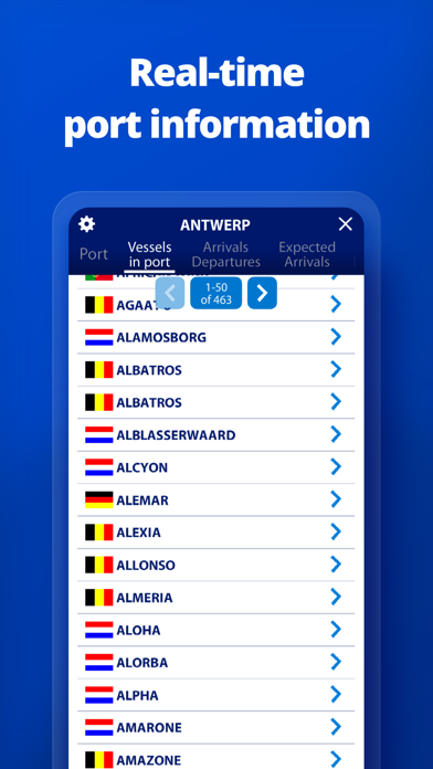
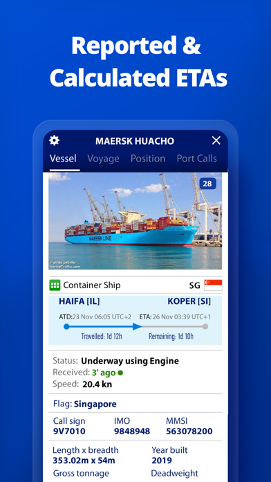
• PORT ARRIVALS & DEPARTURES live for over 4,000 ports and marinas, current conditions in ports and estimated time of arrival for the boats & ships.
• Manage your list of vessels ("MY FLEET"), shared with all your devices and MarineTraffic.com
• Browse 2 MILLION PHOTOS of ships, harbors and lighthouses and much more! You can also upload photos to MarineTraffic directly from your device.
• CRUISE MODE: Track your position, speed and course as well as the positions of the vessels around you. View your projected course, the distance from the nearby vessels and many more.
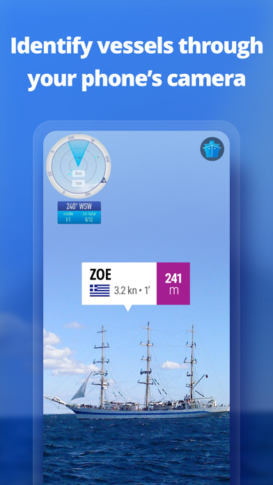
• Identify vessels around you at a glance with the AUGMENTED REALITY tool (in-app purchase)
Just point your device's camera to the horizon and get all the information you need about vessels, ports and lighthouses in your area: name, flag, speed, distance from you and a lot more.
• Use the ROUTE PLANNER tool to plan a route on the map, measure distances and calculate ETA (in-app purchase)
Also, for MarineTraffic subscribers:
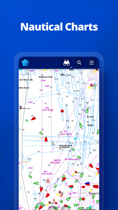
• NAUTICAL CHARTS
• SAT-AIS DATA
Join the great MarineTraffic community!
** If you're only interested in a specific area, please confirm coverage on www.marinetraffic.com before purchasing the app **
Reviews
Keeping track.
OldFart DeWitt
I use the app to keep track of our son and his,wife on Saving Grace out of the Northwest Creek Marina in North Carolina. Robert DeWitt
Nice when it works
Docrobert2020
We left Florida to go cruising in the Caribbean and had friends and family that wanted to see where we were. I, unfortunately, suggested this app and they all purchased it. Now it RARELY updates my position. For example we spent 3 days in a marina on Great Exuma and it never updated. It updated once when we were sailing off the north coast of the same island. Now after 4 days anchored 9 miles north we have not updated. Other cruisers in the anchorage are showing up. Keep in mind that we have brand new Vesper AIS and we show up on other cruisers Navionics and WatchMate consistently. Only answer I got is maybe we need to upgrade to “satellite version “. This is the response from tech support, “ The lack of Updated Positions of a vessel can be a result of a number of factors. Signal strength, functional transponder, local (vessel area) and surrounding (nearby stations) weather conditions, temperatures, traffic and the satellite constellation frequency are some of the most important ones. After checking on this further, I can see as well that your vessel is equipped with a Class B AIS Transponder. Please note that the above information is especially true for vessels equipped with a Class B AIS Transponder as their signal may be weaker.
Great app!
Stag Islander
I love this app. I use it to follow freighters around the Great Lakes. You can even select your own favorite ships to follow. Five stars!
Not worth even downloading and I fish in Alaska
Youngguns69
Thing doesn’t work worth beans without paying money at every turn it’s a joke I deleted it within a day
Awesome
Semper Cop
Our son is a Great Lakes pilot and we can “cyberstalk” his boat around the lakes. If we time it right, sometimes we can catch him and take him a pizza or out to lunch.
Deceiving?
jeryall
I downloaded this app to track my son who is a scalloped. It doesn't seem to work unless I pay the extra .99 a day for satellite. Seems to me they're must be a better way.