QuakeFeed Earthquake Tracker
| Category | Price | Seller | Device |
|---|---|---|---|
| Weather | Free | Artisan Global LLC | iPhone, iPad, iPod |

--> No banner ads
--> Quick and very easy to use
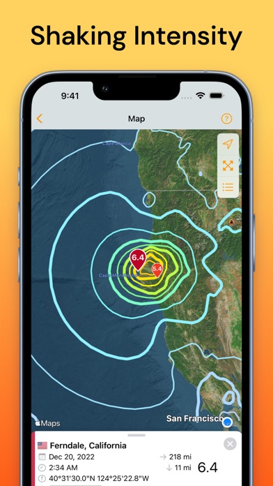
--> Eight beautiful basemaps plus plate lines
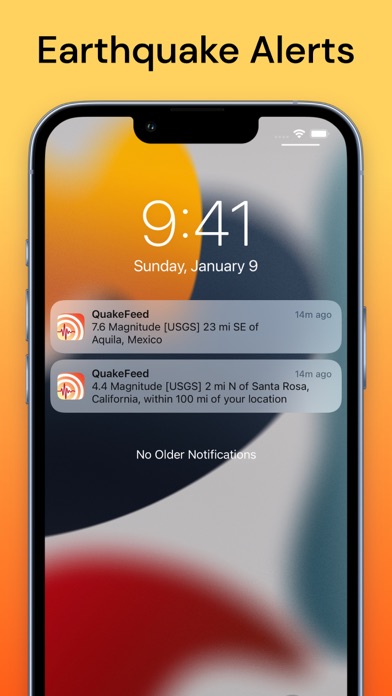
--> Free alerts for M6.0+ quakes worldwide
--> Customizable alerts via In-App Purchase
--> Curated earthquake news and announcements
--> Great educational tool
--> Offers, tips and information when you open the app while in a participating local merchant. You can opt out, please see the Privacy FAQ for details.
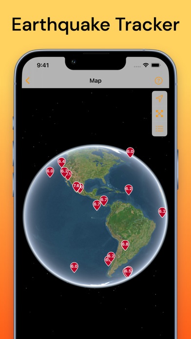
Our mapping features are truly stunning. Want a unique perspective on the quakes? View them on shaded relief or a map of the ocean floor. It will deepen your understanding - try it and you'll see what we mean!
QuakeFeed offers a variety of filter / sort options to let you see the quakes that are most important to you. Beautiful UI - check out our reviews, people love our simple, uncluttered design! And QuakeFeed is a universal app optimized for both the iPad and iPhone.
BASIC FEATURES
* Choose from six different USGS Data Feeds
* Push notifications for all M6.0+ quakes
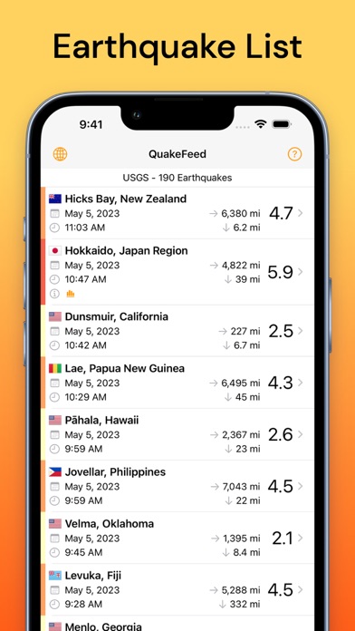
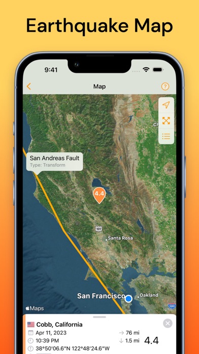
* Quakes displayed in a list or on a map
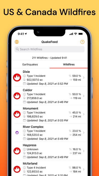
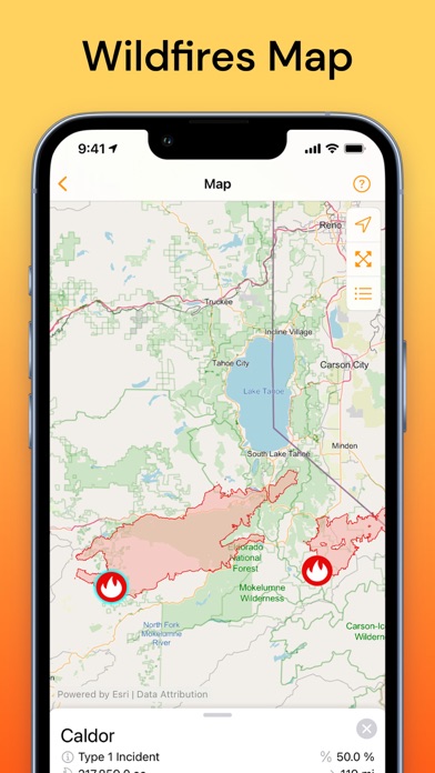
* Search, sort, or filter list
* Drill down to quake details view:
-- Map zooms to quake location
-- Magnitude, time, lat/long, distance, depth
-- Link to quake details on USGS website
-- Link to NOAA Tsunami Warning Center (if available)
-- Link to USGS "Did You Feel It?" page
* Earthquake news
* Earthquake preparedness information
* Social media integration - share via:
-- Facebook
-- Twitter
-- Email
INTUITIVE USER INTERFACE
* Color-coded map symbols with optional magnitude display
* Quake list color-coded by magnitude
* Sort list by date, magnitude, depth, or distance from current location
* Filter list or map by magnitude and/or distance from current location
* Pull to refresh list
* GPS button for zoom to current location
* Specify units for distance and depth (km or miles)
* All screens work in portrait or landscape mode
ENHANCED MAPPING CAPABILITIES
* Eight different basemap options:
-- Street Map
-- Satellite Imagery
-- Imagery with Labels
-- Ocean Bathymetry
-- Topographic Map
-- Shaded Relief Map
-- Physical Map
-- Terrain Map
* Display plate lines as a map overlay
* Pinch to zoom / drag to pan
* One touch zoom in / two touch zoom out
SUGGESTIONS? QUESTIONS?
Contact us at [email protected] or visit http://quakefeed.com -- we usually respond within 24 hrs!
Reviews
Wondering about time
bachelorette miami
Hi, I just found your app because I’m living in Puerto Rico and we are having a lot of earthquakes here. I noticed the alerts notification are 1 hour later . I don’t know if you could help me to fix this issue. In example , the notification reported that it’s just happened an earthquake 1 minute or 2 ago but the time that the event happened was an hour ago. I don’t know if it’s because Puerto Rico didn’t change to summer time like Florida . If you could help to understand, I really appreciate.
Good but has bugs
Joylpz
I filter to receive notifications about magnitude 5.0 or above and it always resets back to 2.0. Besides that, the app is very good and easy to use.