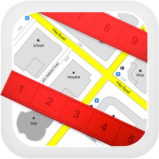
Planimeter for map measure
| Category | Price | Seller | Device |
|---|---|---|---|
| Utilities | Free | Zhong Zhang | iPhone, iPad, iPod |


It can measure anything visible on the satellite map, like lawns, fences, farm, road, roofs and so on.
~~~~~~~~~~~~~~~~~~~~~~~~~~~~~~~~~~~~
● Thanks to more than 3250,000 people who have chosen "Planimeter Pro"
● "GREAT - Wonderful app. Very useful and easy to use. Most of the time I use it to measure distance sailed on San Diego bay." by Perfent
● "Great app for an accurate measurement - This app saves a lot of driving around! Good in the hi res areas" by DaveHebner
~~~~~~~~~~~~~~~~~~~~~~~~~~~~~~~~~~~~
Features:
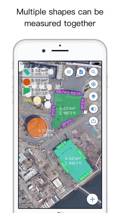
● Support measure distance and area.
● Support measure as path, polygon, star or circle.
● Support measure multiple area at same time.
● Visual records list, save and share.
● Support Apple map and Google map.
● Use cross hair to location, easy and accurate.
● Locate by search or GPS.
● Support length unit like foot, nautical mile, mile,inch, yard, meter,kilometer.
● Support area unit like square meter, are, declare, hectare, square kilometer,acre and so on.
● Support custom unit, add any unit your needed.
● Fill color, board color and text is configurable.
● Support live record by GPS.
"Continued use of GPS running in the background can dramatically decrease battery life."
Reviews
How do I?
DigDug615
Having trouble learning how to use the app? I turned on instruction, but it only asked me to input info. No next step? What am I doing wrong here?!
Please contact me
Duke of Hempshire
I love this app, use the demo version all the time. When I downloaded the paid version it had a bug that crashed the app time and again. I see that bug has been fixed since however I am unable to download it again because my iTunes account was refunded however it has not been removed from iTunes and refuses to update or give me a way to purchase it again because it’s stuck on update. The link to contact the developer loops me back to iTunes where I can only “Update” but it doesn’t update and I click the link to the developer, which links me to iTunes, which links me back to the developer, which links me to iTunes. So... pretty frustrating.
Planaview, is so great!
KosephD
I am a family history/history nut. I am using Planaview Pro to establish the location of structures long gone by taking measurements from structures still standing and compass readings plus GPS locations to mark the locations of the missing structures. I am also using an aerial view showing all of the structures, Neat!
Exactly what I was looking for!
Hmmmmmm,
This is my go- to app for measuring distances or acreage on the farm. For fumigation plans, acre calculations to plant a cover crop, as the crow flies distances, and row length calculations this is everything you need and easy to use. I used to have to pace everything off or use a wheel, well now I can mark the corners on the map (that is up to date and accurate using location services) and it's done. If putting together a new field or trying to calculate riparian buffer zones or anything, you can drop points right where you want the new corners or borders to be, and easily get area from there. All in all this is a great, easy to use, well designed app that is "paid for" quality yet free. Highly recommended for the niche group of people like me who need it!
Terrible
SealingTheway4days
Can't look up specific addresses to do measurements. Only pings on current location.