Georgia S to N Carolina Charts
| Category | Price | Seller | Device |
|---|---|---|---|
| Navigation | $6.99 | Flytomap | iPhone, iPad, iPod |

Top Ten since 2008
Featured in : On the Deck
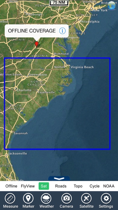
Georgia South - North Carolina coverage resident in the app. It works WITHOUT mobile coverage!
• Worldwide Marine and Outdoor Maps available when connected, thanks to viewer.flytomap.com
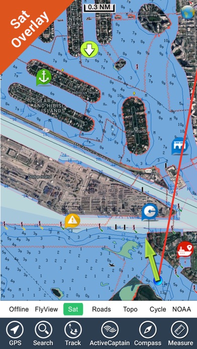
• Worldwide Satellite images overlay on charts
• Worldwide Terrain features overlay on charts, thanks to Open Street Map, Open Cycle Map, Bing,Earth,Topo Chart and GMap
• Local Marine Weather forecast
Now with NOAA raster charts seamless with continuous updates from the official Government server
Now with ActiveCaptain - Worldwide boaters community, with * 200.000 + Captains
Use to Explore:
√ Latitudes and Longitudes to go to your favorite places
√ Search your Favorite points directly
√ Zoom, Rotate and Pan fast just by a finger touch
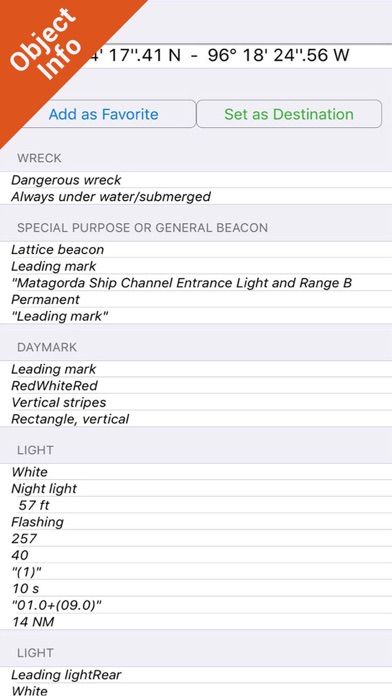
√ Quick Object information just tapping, thanks to vector technology
√ GPS Heading Vector Towards the direction movement
√ Distance Measurement Tool to easily calculate the distance from one location to another
√ Route planning, Waypoints - Insert the target/destination and see in real time your speed, distance and bearing
√ Magnified Lens for all info
√ Unlimited Tracks, Markers, Geo-tagged photos, records and share via email, visible on Google, Flytomap Viewer, KMZ format - Store your track without the need of cellular data or mobile signal
√ Select Depth Contours
√ a la carte menu
√ MOB - Man Over Board
√ Quick WP - allows you to instantly record your position and show distance and bearing
√ iOS background mode - Flytomap works in background as well, you can swap with another app and receive/make calls send sms while track recording.
√ Optimized battery usage
√ ActiveCaptain
• View and contribute to the best boaters community available in the world
• Continuous update of all info (including reviews from the deck) about :
• Marinas
• Anchorages
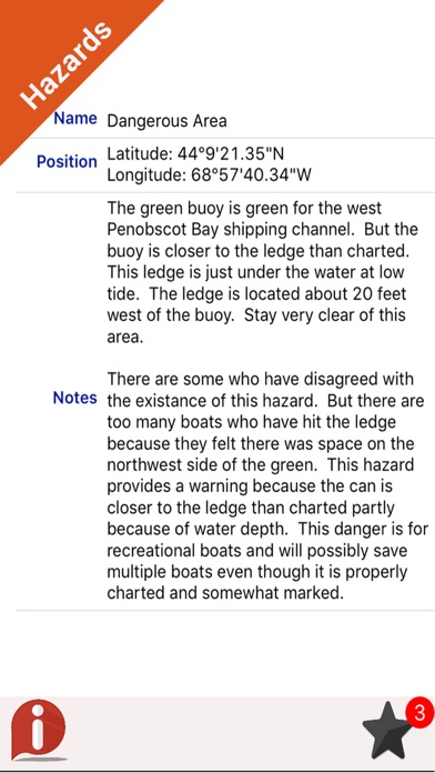
• Hazards
• Local Knowledge
√ Worldwide Marine Weather forecast at a quick tap provide you:
• Day max and min temperature - Current temperature
• Significant wave height, Swell height, Swell period, Swell direction
• Tide data
• Sea temperature
• Wind Speed and direction
• Weather description
• Precipitation & Humidity
• Visibility
• Pressure
• Cloud cover in percentage
• Wind chill/Feels like Temperature
• Water Temperature
• Dew Point Temperature
• Heat Index Temperature
√ And so much more to come - It’s the only app you will ever need! Our charts are installed on: GARMIN NAVICO LOWRANCE B&G NORTHSTAR EAGLE SIMRAD
Follow us:
▶Twitter @flytomap
▶Web Site flytomap.com
▶Web App viewer.flytomap.com
▶Facebook facebook.com/flytomap
Flytomap is committed to constant improvement, this App is developed with the help of professional boaters to get the best experience on the sea, we listen to our users and systematically add the most requested features.
Thank you for the feedback!
"Continued use of GPS running in the background can dramatically decrease battery life."
Reviews
Nice FES
krylt
i lIKE the new VER.! All DES are clear with many PTS and large selection of OPTS.......The Compass, guide search is very helpful too.
No lakes
micjoey
This may be a descent app for part of the east coast but as far as I can tell there are no lake maps available. After purchasing I was directed to there website where you are able to purchase a a couple of lakes up north. No use to me. A complete waste of my money. I want my 3 bucks back.
Worth
Kiaflor
Just does what it’s supposed to do. Great to see the hybrid, offline maps showing real cool details for boating. It helps set target waypoints, track directions & email them to friends and anyone. This is one of those apps that you must get to have for your boating, well worth the price.
Great app!!
Breg_Allen
For someone who is not very computer or technically savvy, I found it very easy to navigate through. I have had no complaints so far.
Awesome
Jason.dean
There is a lot of improvement in the map functionalities compared to older versions. App is easy to use and has a great tracks recording and email option which is awesome to have it on my iPhone.
Works!
Bobbe@1
Thank you for the App. Without it I would never have sailed. Downloaded and it seems to be working OK!