FlyToMap All in One GPS maps marine lakes parks
| Category | Price | Seller | Device |
|---|---|---|---|
| Navigation | $11.99 | Flytomap | iPhone, iPad, iPod |


Top Ten since 2008
Featured in : On the Deck
► The charts downloaded are resident in the app. It works WITHOUT mobile coverage!
Flytomap All In One HD works on all Apple devices
FlyToMap™ offers a revolutionary app; you can download any chart worldwide (500+) free of charge
- All USA Marine charts (US All, East, West, Great Lakes, Major Rivers,Florida, Texas, California, etc.)
- more than 150 US Parks and Forests
- New Zealand Nautical charts
- All Europe marine charts
- 200+ major EU parks
- most famous world holiday ie: Caribbean, Seychelles, Mauritius, Maldives, Canary Islands, Azores, Bora Bora, Bali, Oslo Fjord .. and many more.
- USA Lake Maps 15000+ : Minnesota, Maine, Michigan, Massachusetts, Wisconsin, Texas,California, Florida,Iowa,North and South Dakota...and many more.
-Canada Lake Maps: Alberta, Lake of the Wood.. and many more.
► Worldwide Marine and Outdoor Maps available, thanks to viewer.flytomap.com
► Worldwide Satellite images overlay on charts
► Worldwide Terrain features overlay on charts, thanks to Open Street Map, Open Cycle Map, Bing,Earth,GMap
►Interactive Weather forecast
►NOAA raster charts seamless with continuous updates from the official Government server
Now with ActiveCaptain - Worldwide boaters community, with * 200.000 + Captains
Use to Explore:
√ Latitudes and Longitudes to go to your favorite places
√ Search your Favorite points directly
√ Zoom, Rotate and Pan fast just by a finger touch
√ Quick Object information just tapping, thanks to vector technology
√ GPS Heading Vector Towards the direction movement
√ Distance Measurement Tool to easily calculate the distance from one location to another
√ Route planning, Waypoints - Insert the target/destination and see in real time your speed, distance and bearing
√ Magnified Lens for all info
√ Unlimited Tracks, Markers, Geo-tagged photos, records and share via email, visible on Google, Flytomap Viewer, KMZ format - Store your track without the need of cellular data or mobile signal
√ Select Depth Contours
√ a la carte menu
√ iOS background mode - Flytomap works in background as well, you can swap with another app and receive/make calls send sms while track recording.
√ Optimized battery usage
√ And so much more to come - It’s the only app you will ever need! Our charts are installed on: GARMIN NAVICO LOWRANCE B&G NORTHSTAR EAGLE SIMRAD
Follow us:
▶ Twitter @flytomap
▶ Web Site flytomap.com
▶ Facebook facebook.com/flytomap
FlytoMap™ has a wide range of Applications and Maps for you to use - Free of charge on Flytomap All In One !
- WATER MAPS
Electronic Nautical Charts (ENC) from NOAA and Corps of Engineers compressed to store the largest coverage. You can transform your device in a chart plotter with best NOAA-USACE, ENC S57 cartography; which includes Coastline, Anchoring areas, Fishing areas, Restriction areas, Obstructions, Rocks, Buoys, Beacons, Lights, Depth contours, Spot Soundings and more.
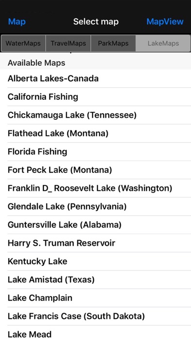
- LAKE MAPS
High quality lake maps with detailed information and important features compressed to assure the larger coverage. Lake maps contain the most important lakes with detailed Depth Contours, Boat Ramps, Fishing spots etc. Maps also include Trails, Roads and Railways information.
- PARK MAPS:
Extremely advanced embedded electronic charts with all information collected from the National/State Park and Forest Services and many other local sources. The maps contain all trails (Hiking, Biking, Equestrian trails etc.,) and Points of interests (POI) like Campgrounds, Visitor Centers, Lookout points, Eating places, Ranger Stations, Picnic areas, Boat/Canoe ramps, Parking areas etc..
- TRAVEL MAPS
These Maps cover most interesting touristic areas combining Sea and Land information to allow you a complete travel experience.
Continued use of GPS running in background can decrease battery life.
Reviews
Maps are awesome!
BrianLLmro
Currently among all navigational apps on Appstore this one is the best for the price, the information and the features. I think this app is a must for any iphone or ipad user for sailing and navigation. Gps is accurate, tracking, waypoints, finding directions, photo geo-tagging and the volume of features integrated into one app is too Great! This app made me Kick back all my Gps units.
Was excited... then looked at it. Lousy
bilbrey.j.m.
I was excited today when I saw that there was an update to this APP and it specifically said that it had Wisconsin (and other State) lakes included. I couldn't find any lake that was included other than Lake Michigan and Superior. Even Winnebago isn't mapped! Then i looked at the level of detail on the map for Lake Michigan, where I just happened to be doing some fishing today, and the contours are still at a very high level. Compare this to the APP I used today on Lake Michigan, the NAVIONICS MARINE - US CENTRAL. That app had great detail, even showing rock piles, fish net moorings, navigational markers, etc, at a 4x greater countour detail than this Fly-to-Map app. NAVIONICS still doesn't have all the inland lakes mapped either... I wish these developers would get on it - it can't be that difficult for them to upload their existing lake maps. I suppose they want me to buy a "Lakes" chip and put it in their $700 hardware and tie it to one boat... first one to get inland lakes in an iphone app gets my money!
Overall it's awesome!
Jamit Jamit
App got steerful information to sail for some great coastal regions. Offline Maps are extremely useful and well worth exploring the depths of sea. I like the map for having combination of all features like Map GPS, Favorites, target waypoints, tracks, compass, guide etc. in a single app, which is a must for boating, in addition to this integration of lake maps especially for fishing spots are a highlight. Well done!
Genius!
1E1maniel
App is fantastic! A must have for iPhone. Easy to use and very useful, the surprise for me was that I can download other maps (many) for free! provides step by step instructions in user guide on how to use the app and I almost like all map functions including which were added in the latest update which are more user friendly for navigation. This is by far the best app I’ve ever seen in the entier Appstore.
Well Worth!!!
RICHARD_BEL
Awesome! Got maps for all over the world areas and all are free to download! No need to purchase seperate maps everytime and spend lot of dollars! This map rocks!!!
User friendly
Kiaflor
This is the ultimate of all GPS apps I've used. I use maps when sailing, hiking,on road rides to view, share my locations & tracks. These maps are amazing to use the iPhone's technology, they load very fast, easy to use & has an array of features like tracking and email. It's been very useful and handy.
Amazing
Bart55K
I have tried many Gps offline apps but this one's the best of all. Works perfectly, got awesome information and a good value for my iphone. Features like tracking paths and sending them to anyone are awesome. It shows exact locations anywhere on the map which is superb. This is my favorite app on my iphone. Worth it!