Flat Earth - Satellite Image Viewer Reviews – Page 2
4/5 rating based on 19 reviews. Read all reviews for Flat Earth - Satellite Image Viewer for iPhone.
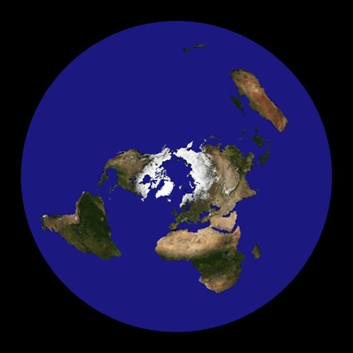
Flat Earth - Satellite Image Viewer is free iOS app published by Tomoyuki Seno
Satellite and Flat earth ?
Raju Grewal
I believe in flat earth, but this application is providing no information. This application is based on global earth, whenever we click anywhere, it shows 2D version of globe earth model.
TOTAL disappointment!!'
Slinky311
This is all wrong! For starters, this map clearly shows the earth as a "flat" model, but there are no other changes. It's simply made into a flat version of what is already taught! Antarctica is not surrounding the earth, but at the bottom, just as the ball form. Lies! Don't waste your time. On top of that, the description says it's a SATELLITE IMAGE of the flat earth! That statement, in itself is one huge contradiction!
It's Flat!!!
Katenvon
Thanks for takes the time to put this app together, I look forward to future updates.
Display issue
hi_31001
I love this app, but please fix the display box for distance!! When you find the distance between London and LA, there is not enough room in the display box to actually show it! Just reduce the font size, or increase the box size, or reduce the significant digits in the degrees. Really cool app.
AWESOME
Spencer Marshall
Finally a visual I share to people who try to disprove the flat earth. Only problem is hard to control but oh well!
Didn't like it
Rah is
First, this isn't a proper representation of the flat earth map. As soon as you give the app location permissions it looses its Antartica boarder, then flattens out what looks like the globe map with Antartica as a continent. The Ice Border is a Big One to get wrong on a Flat Earth map.