Wyoming 511
| Category | Price | Seller | Device |
|---|---|---|---|
| Navigation | Free | Wyoming Department of Transportation | iPhone, iPad, iPod |
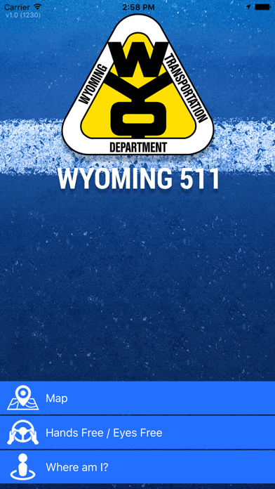
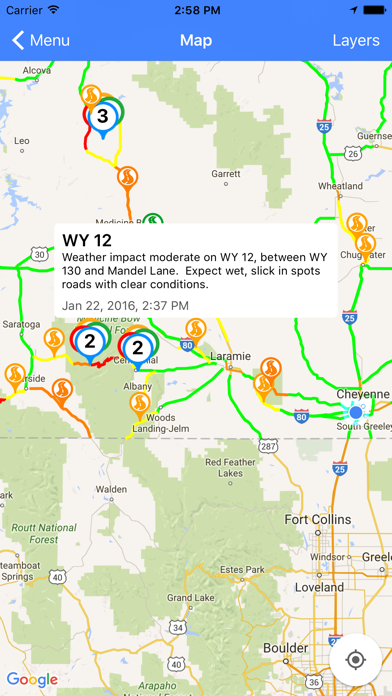
- Provides pre-trip map-based road and traffic conditions (Map)
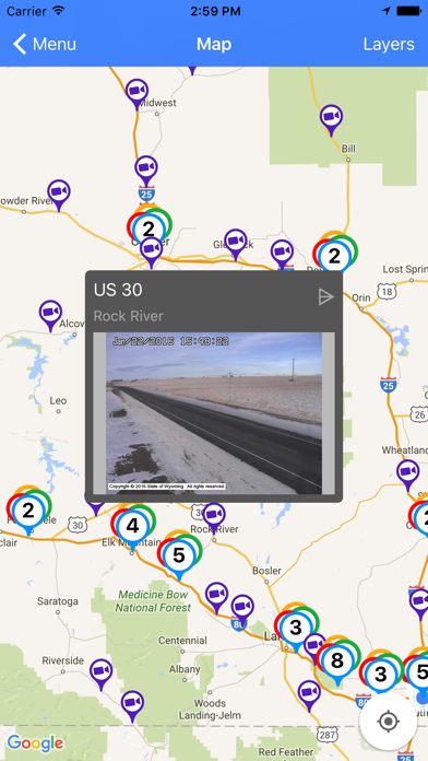
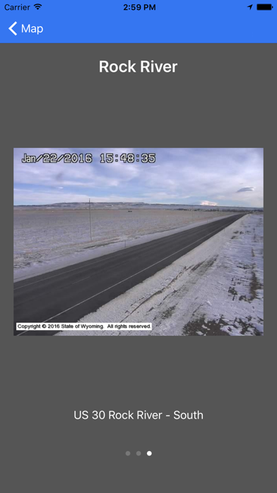
- Displays web camera images (Map)
- Displays weather station data (Map)
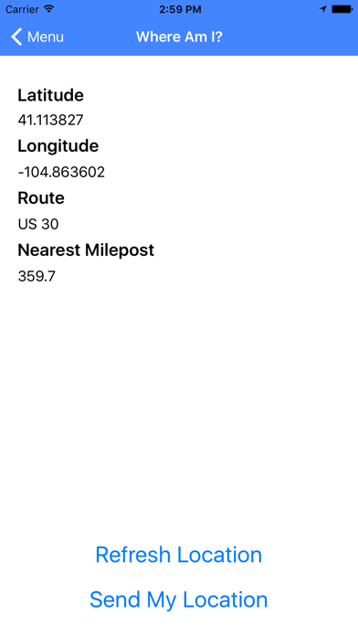
- Shows users their route and mile marker location, and includes latitude / longitude (Where Am I?)
- Speaks conditions so drivers know what they can expect on the road ahead (Hands-Free / Eyes-Free)
- Alerts drivers to traffic information, including crashes and other hazards within a user-specified radius (Hands-Free / Eyes-Free)
- Updates data from WYDOT’s servers every 15 minutes when a data connection is available
- Uses GPS to provide location-based reports
Reviews
Good start
Wyocuban
This is a good start. Would love to see the list of road conditions for each road as it is on the mobile site - which I use daily in the winter. Would like to see alerts on phone based on selected location with notification feature Good job WYDOT. Keep it coming!
Ok
TLakia
The map pops up with numbers. Click on the numbers, the map zooms. No legend for said numbers. Click on the cameras and the warning is pretty cool. Needs some improvement. Good start though.
Nice to see...
Diverdownwy
Haven't played with it much yet. Looks like a nice design. You should seriously consider adding the ability to make ECAR reports through this app. Of course not while driving, it could add a bunch of real time data. Especially if there was the ability to upload a picture, or short video of road spots that are in bad shape. Let's face it plows and troopers can't cover everything all the time.
It's a start
3/4 Irish
It's an ok app to start with. Wyoming has an excellent system of highway signboards that don't appear to be available in the app ... yet. A great alternative app is Wyoming Traveler; that's my go-to app, and maybe one day the Wyoming 511 app will be as good, if not better.
Good state run app
Rumor risk
I drive the west coast and this is one of the better ones from a state. One thing I would like to see is the addition of a weather forecast, and incidents like on utah's. Overall a great app much better than the independent ones.
Blows
TDubYa406
Have had this app for 2 weeks every time I try to open the map it just turns blue and doesn't load. I've tried wifi and even deleting and downloading it again still does not load map.
Good app but needs a tweak!
746SOM
As other user reported, map turns blue. If you don't allow the your Location to be set, the default is set to somewhere off the coast of Africa. So you have to scroll back to WY. If you allow your Location, you still have to scroll if you aren't in WY! Please set location to WY!!!!!!
Tons of great info but...
JamesinDen
It would be nice to plot my drive and filter out all the other reports that will not affect my course. Showing everything is pretty confusing.