USFS & BLM Campgrounds
| Category | Price | Seller | Device |
|---|---|---|---|
| Travel | $0.99 | William Modesitt | iPhone, iPad, iPod |
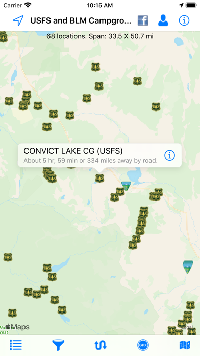
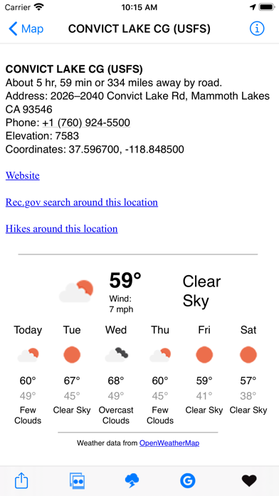
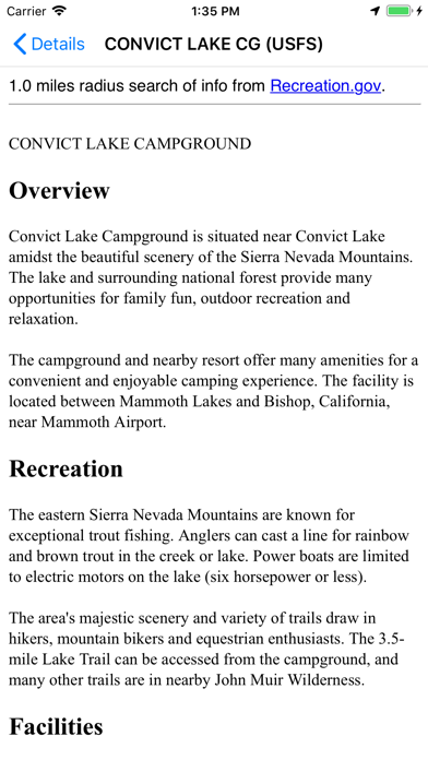
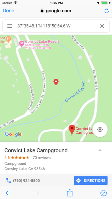
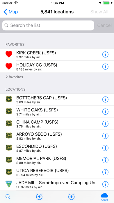
These types of campgrounds tend to be low cost or free. Each location displays the campground name, which agency administers it (BLM or USFS), the local weather, elevation, Internet images and searches of the campground, Flickr geotag search, rec.gov info, and more. Easily locate the campgrounds nearest you. Send location data directly to our Road Trip Planner app.
Import routes from GPX files. This makes it much easier to find locations along your route.
- Show a route between your location and the campground.
- Map layers include Apple, Google, and Open Street Maps.
Bonus! Includes over 480 KOA (Kampground of America) locations (if desired, these locations can be removed via the Filter).
Reviews
Great App Needs more specifics
Pinkie pink pink
This app is great for locating where the campgrounds are, however it would be nice to have types, lengths of spots and how many spots. Contact info for campground would be nice to see.
Poor design, nothing that you can’t get for free elsewhere
thejtap77
The design is messy, this is basically the same app as Boondocking, except it costs $$. No info on BLM dispersed camping or costs for campground sites.
Indispensable app
KramerEA
I’ve been using this app for about 2 years now and am thoroughly satisfied.
Near Useless
BelayOn
I’ve checked whether FS/BLM sites I know, that are substantial sites, is included in this app. They are not. I’ve found other apps that are more complete. This one isnt worth the resources to keep
Well Worth the Effort!
sonofsteeno
You may have to search through some minutiae in that the filters aren’t overly specific. But there are tons of great campsites here to find, if you invest the time to do so.
Amazing
Michaela46
Best $1 I’ve spent recently! This app is even partially accessible when there is no cell service!! Also I love the elevation info.
Missing vital info.
sweetpea53
This app is great for finding campgrounds. However, the base map does not show FS and BLM land boundaries. Since we can disperse camp on much of this land it would be most helpful if we knew we were on public land or not.