US Fires
| Category | Price | Seller | Device |
|---|---|---|---|
| News | Free | P4G Pty Ltd | iPhone, iPad, iPod |

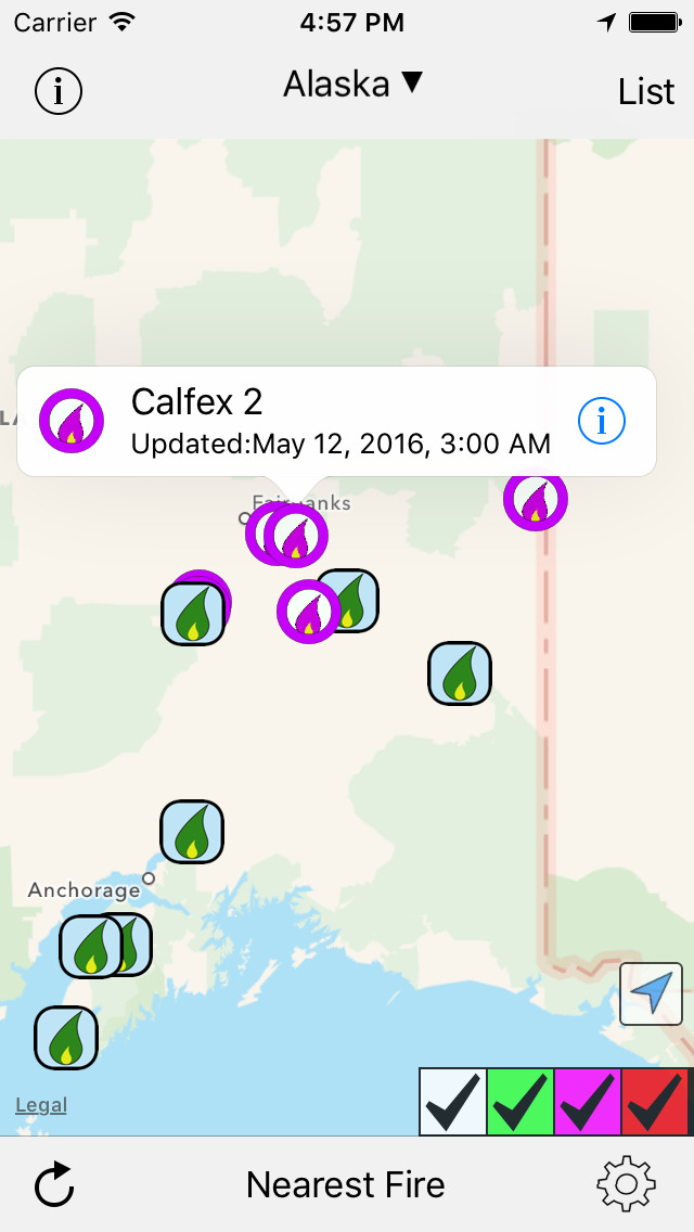


With this latest version we have REMOVED all in app purchasing of states, so now you can access fire information for any state we have data for. It is also possible to overlay the fire information with the thermal satellite data from the USDA to help locate the fires and their extent.
While all care has been taken to provide the information as accurately as possible, the application does rely on both an internet connection and on accurate data being provided by inciweb.org and USDA.
We do recommend that you utilize official forms of communication regarding fires to ensure your safety and follow their instructions. We take no responsibility on actions people take based on the information or lack of information provided by this application.
There is InApp patronage available to help support the ongoing server and update costs. Thank you to all who provide patronage.
We do ask that users send feedback to P4G ([email protected]) directly, as without this feedback we can not fix your particular issue and make the application suit your needs.
Reviews
Okay so far ...
StupidGreedyCorporateDroid
Have been using the app during the 2019 RV season in the SW USA and it has been useful for avoiding smelly, eye and lung irritating burning areas. The links I've clicked on to more fire site info within the app have worked. The app brings together info that is freely available of course, but, it is the handiness of a single point of access that makes the app useful and adds value for me. If allowed/possible it would be really nice if the developer(s) could also include links to the public data for actual and projected smoke plumes. An excellent companion app to use alongside US Fires is LuckGrib.app.
Works Well
Sam_whocantfindaname
Lets you know where the fire is and if it’s contained or not. It’s simple and doesn’t waste your time trying to force signing up for an account.
Not being properly updated!
Sierra Quail
This app used to be great! However, it has deteriorated lately. I live in Reno, NV, where many fires are burning not far from here. One of the closest, the Truckee Fire in the Wadsworth area, has grown to 109 square miles, over 70,000 acres. The app hasn't updated this fire since July 2, when the fire was still at 4,500 acres. Same problem with other fires. To be useful this app needs to stay current. Otherwise, why pay for in-app purchases.
US Fires
Mema2000
Once you purchase this, one must then purchase each state for .99 - the maps are topographical so locations are hard to determine unless you are very familiar with the area. The maps on the WWW from the forest service are a better bet.
Meh
blkschnauzerlvr
Total waste. Plus, who wants to pay 99 cents for EACH state? I certainly wouldn't. DELETE........
Potential...
Sandibatch
Has a lot of potential. Would like to see state fire agency added. Nice if we can get all info in one place. Webmaster is very interested in improvement. Keep working on it!
Free information or not
Boca Bucky
This app claims to be free but once you download the app they charge you a $1 per state to see the information. You can just as easily get online with the US Forest Service and get the information. All in all it's not worth wasting the space on your phone.
Come on!
florawora
This is not a free app! Gives you one state and all others cost $1 each!!! Terrible setup!
Awful fraudulent crap
Oceptis
Data is the same as you get from pointing to a map with your eyes closed. And you even hand drew the map. Free my $&@!