TraceMyTrack
| Category | Price | Seller | Device |
|---|---|---|---|
| Travel | Free | Corandus GmbH | iPhone, iPad, iPod |
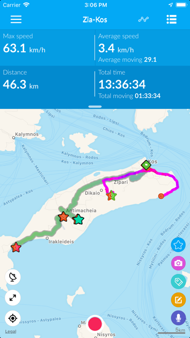
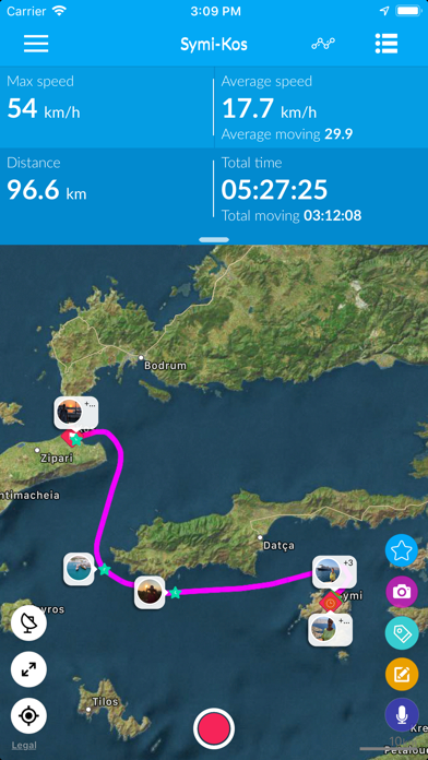
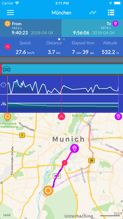
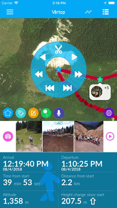


The app is suitable for walks, sightseeing trips, jogging, hiking and trekking, biking, motorcycling or driving. TraceMyTrack provides statistics and information about your track and every single point, such as speed, height, time from start or distance.
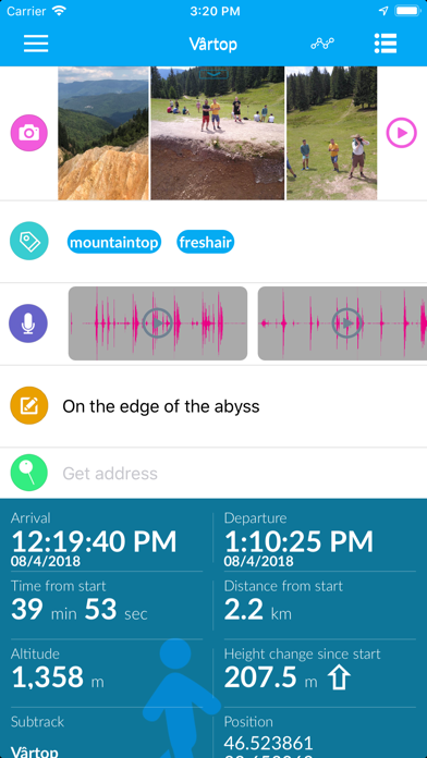
Keep track of your beautiful views or important information directly on the track. You can add photos, descriptions and tags to the track at any time.
You can share tracks with photos, point information or statistics with your friends or family across all major social media platforms. For this purpose, our new Story Card supports you with various layout profiles.
What TraceMyTrack can do:
- Personalize your track by adding photos, descriptions, or tags to the items that are most important to you.
- Choose from five battery profiles the one that best suits your planned activities.
- Share your favorite tracks as a story cards across all major social media such as Facebook, Instagram, or via messaging services such as Email, Whatsapp, and more. For this you can choose from among different layout profiles.
- Let TraceMyTrack automatically assign photos to your points when you are in a hurry.
- Have an overview of all the places where you have stopped and enjoyed the moment. TraceMyTrack automatically marks your standing points.
- Your data belongs only to you. Everything TraceMyTrack records is saved locally on your device.
A user-friendly app:
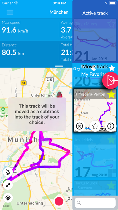
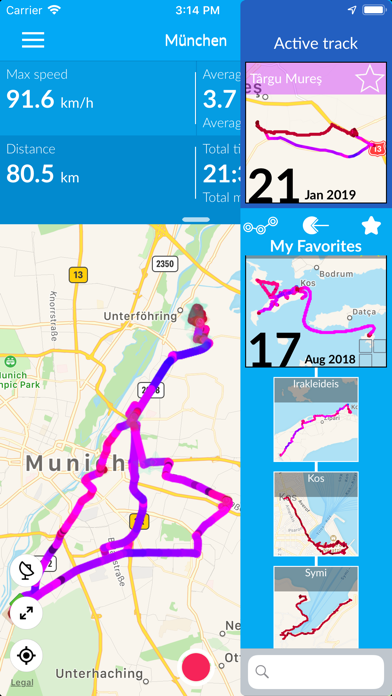
- Story cards to share your tracks, subtracks, pictures and statistics with your friends
- A widget that allows you to control the app from the lock screen on the go
- Friendly and appealing user interface
- Full-screen view of the map to get a better overview of your track
- Easy navigation between points
Good design follows the function:
- Live tracking on the map or running in the background
- Use the color of the track to see your speed
- Point icons of different colors and sizes, each with its own function and information
- Activities such as standing, walking, driving, jogging, cycling can be visualized on the track
- Picture preview, descriptions and tags that enrich your track with relevant information
More advantages:
- Multilingual app: English, German, Hungarian, Romanian
- Export tracks in formats such as CSV, GPX, and KML optionally with images. This function is only available in the PRO version
- Display locations in native map applications
Upgrade to PRO:
- Enjoy an unlimited number of points on your recorded tracks
- Record as many tracks as you want!
- Export your tracks as KML, KMZ (with pictures), CSV or GPX files, so you can open them easily with Google Earth and visualize the point information, such as images and descriptions
- Export tracks in TraceMyTrack format allowing you to share tracks with your friends, family and between your devices.
- Import KML/ KMZ files as tracks.
- Let TraceMyTrack auto assign photos you take while the app is recording in background, to their correct position on track, without you having to worry about them
- Display additional informations about points in “info bubbles” right on map
- Note: TraceMyTrack Lite allows you to record a maximum of 250 points per track and a maximum number of 5 tracks. You can delete tracks at any time to record additional ones.