Roadbook
| Category | Price | Seller | Device |
|---|---|---|---|
| Navigation | $1.99 | Romain Quidet | iPhone, iPad, iPod |


Designed for fans of outdoor activities such as:
Walking, road and mountain biking, geocaching, motorcycling, all-road, friends trips and more, this all around the world!
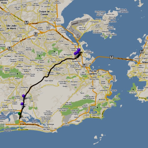
Roadbook is a complete navigation system for iPhone, iPod-Touch* and iPad* which combines the features of a roadbook paper to the power of mobile technology devices from Apple. Enjoy hundreds of electronic roadbooks available on the internet to think outside the box, alone or with friends! Embed offline maps in case you can't reach any network.
*: Warning, on iPod Touch and iPad Wifi, you'll need an external GPS accessory.
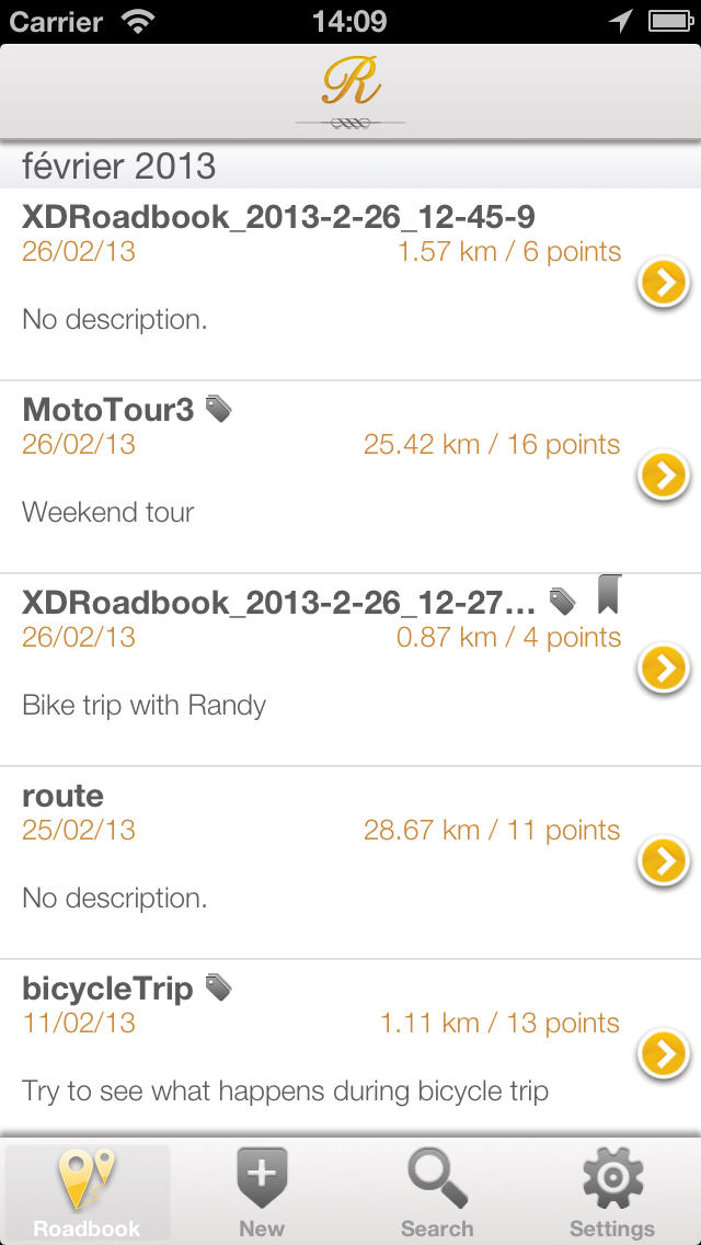
Roadbook management
→ Compatible with any GPX and KML files
→ Open KML and GPX files from Safari and Mail
→ Displays the details such as the number of waypoints and the path distance
→ Sends roadbooks by email
→ Transfer of roadbooks via iTunes (import / export)
Roadbook creation
→ Create from your device new GPX roadbooks
→ Simple and intuitive interface
→ Manual mode with positioning waypoints on the map
→ Automatic mode using the current GPS position (recognition)
→ Add a name, a description and comments for each point of interest
Navigation
→ 3 intuitive modules to follow your path
→ Navigation module
→ Arrow to reach the next waypoint
→ Compass to keep a view of the north
→ Display of course following the true North
→ Orientation Module
→ Arrow orientation to turn to the next waypoint
→ Display information about current waypoint
→ Display information on the current GPS position
→ Measures module
→ Displays the distance between the user and the waypoint
→ Display partial (distance between two waypoints / distance done)
→ Display partial of the entire path
→ Display of the instantaneous velocity
→ Route displayed on a map (requires internet connection, or with downloaded maps)
→ Display the summary of your current ride
→ Ability to easily switch from one landmark to another
→ Intelligent GPS module
Configuration
→ Display units (metric, imperial, nautical)
→ GPS accuracy required
→ Distance to switch automatically points of interest
→ Energy saver mode
The app now handles navigation in background mode (you can close the app in navigation mode, the navigation continues to follow your position).
Continued use of GPS running in the background can dramatically decrease battery life.