RipCharts
| Category | Price | Seller | Device |
|---|---|---|---|
| Sports | Free | RipCharts, LLC. | iPhone, iPad, iPod |
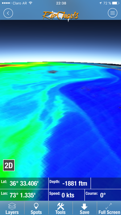
The RipCharts mobile app is a powerful tool that enables offshore fishermen to evaluate recent satellite imagery in order to determine favorable fishing conditions. Search for, view, and download maps of near-realtime satellite imagery onto your device to take with you offshore.
View the latest imagery datasets:
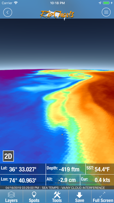
- Raw SST orbit scans
- Composite SST (1day, 3day)
- Multi-Res/Cloud Free SST
- Sub-Surface SST (0m, -25m, -50m, -100m)
- 5 day SST forecast models
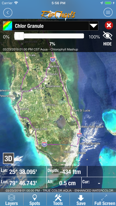
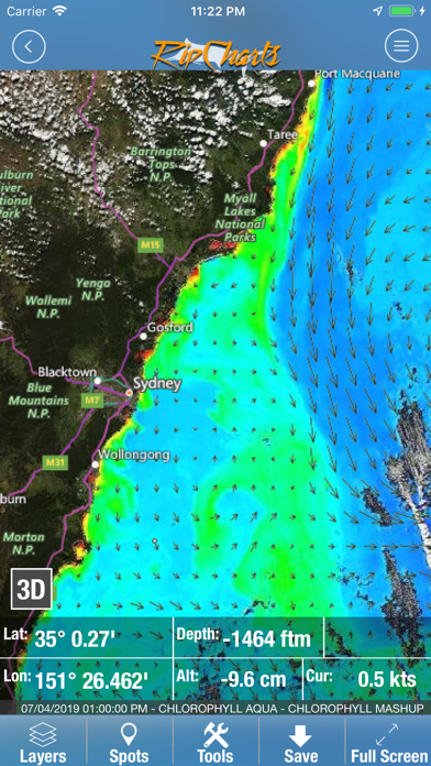
- Chlorophyll
- Chlorophyll/Cloud mashups
- Chlorophyll composites
- True Color
- Altimetry
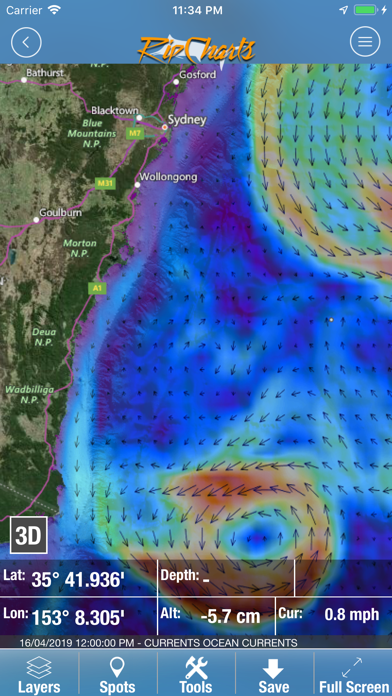
- Currents
- Salinity
- Bathymetry
Map Features:
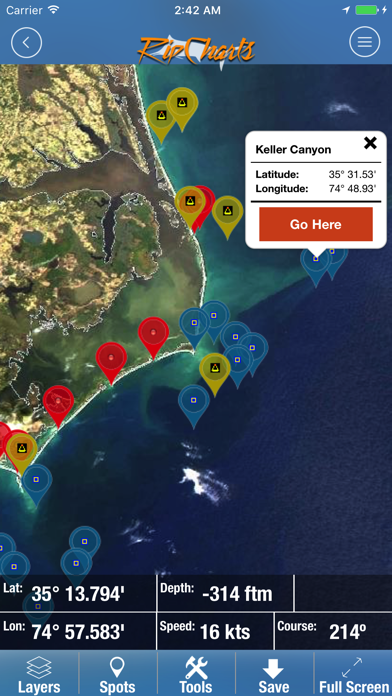
Use the multi-touch map to zoom, pan, view waypoints, and overlay additional data layers to gain insight into where the most favorable fishing zones are located.
Mapping Tools:
- Measure distances and headings between points
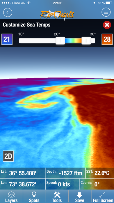
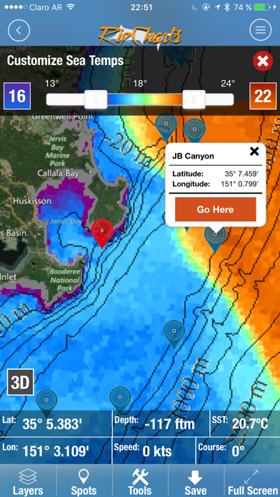
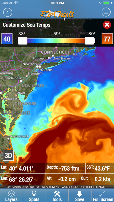
- Dynamically customize temp/color ranges on SST maps to identify subtle breaks <-- powerful feature!
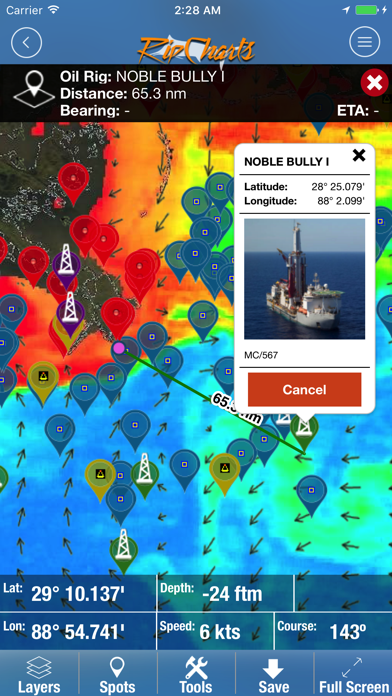
- Overlay bathymetry, altimetry, currents, and Loran layers
- Tap the map to receive point information (lat, lon, depth, SST)
- Popular waypoints and fishing hotspots come pre-loaded
- Manage your personal waypoints (add, edit, delete)
- Save imagery to your device for offline/offshore use
- Show your position and navigate on saved imagery using GPS satellites
- "Go Here" navigation with bearing, ETA, and speed displays
- Floater oil rig positions updated twice daily (Gulf of Mexico only)
Reviews
Good Idea But...
Drwhupass
Seriously guys, you need to offer a free trial option or money back if not satisfied, say within the first 30 days. You are asking customers to pay for something that you have not proven to is that it has any value. Please make the changes and I will be your first customer
Not here in HI
Hawaii channel
Love the app but sorry to say doesn't have Hawaii harbors! Still waiting for refund
Fishing app
Tigersnake1954
Good to figure out before you go, so you spend more time fishing instead of looking.
Great fishing app
NHSOB
If you fish offshore this app helps narrow down the spot you want to fish. The app pays for itself in fuel savings
I wish I seen the reviews before purchasing!
Horatio321
I watched 3 tutorials and I was sold: that’s what I need! I’m giving you 1 star only for the idea - that’s the only pro - the idea. Cons: Not granular enough for ANYTHING!!! There’s no good resolution on anything even the easy stuff. For fishermen fishing within a 30 Mile radius is useless. Then.... YOU PAY YOU GET SCREWED!!!! CANT GET MY MONEY BACK!!!!
Go RipCharts Go!
Sea Tiger Steve
I have subscribed to RipCharts for many years now. I love all the different map views and tools. I find it to be very easy to navigate and they keep adding more features for the same price. Highly recommended! SCUBA Steve from Tementos Dive Center, New Orleans La.