Radar Pro
| Category | Price | Seller | Device |
|---|---|---|---|
| Weather | $4.99 | David Neel | iPhone, iPad, iPod |
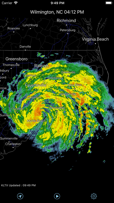
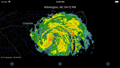
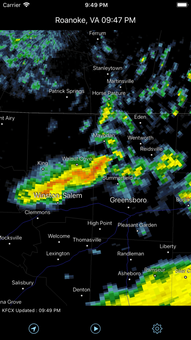
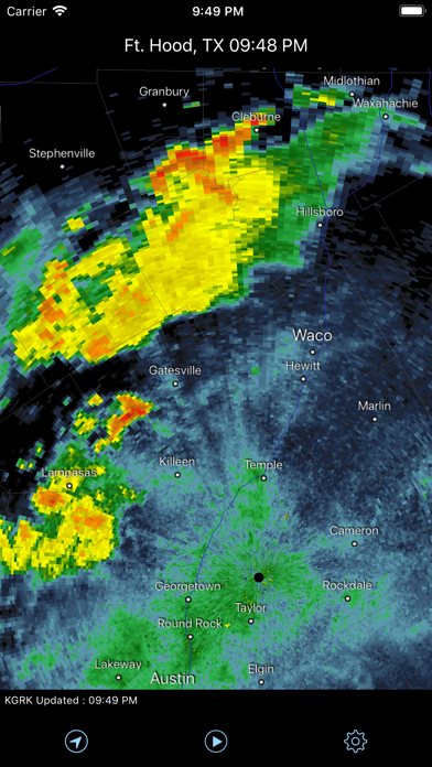
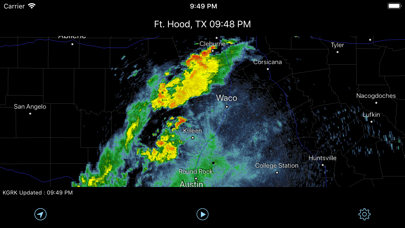
What sets Radar Pro apart from other weather radar apps is that Radar Pro receives radar data directly from the National Weather Service operational servers. The images are in their true, original format and not a smoothed graphic - smoothing any data reduces its accuracy. This means the radar data is the most accurate view of precipitation freely available to the public.
All Severe Weather Warnings for Tornado (Red), Severe Thunderstorm (Yellow), Flash Flood (Green), and Special Marine (Orange) issued by the National Weather Service are displayed on the map and the warning's details can be easily viewed from the Warnings button.
Set the Radar In Motion -- easily begin an animation loop to view storm motion over the past several minutes.
Know exactly where a storm is and where it's going and how it could impact you -- set the radar image in motion and easily begin an animation loop to view storm motion over the past several minutes; and with one touch, your current location is marked on the map so you'll always know where you are in relation to precipitation or severe weather warnings.
Radar data and Severe Warnings can be configured to update at 2, 5, 10, or 15 minute intervals.
Radar Features:
● Level 3 NEXRAD display to 248 nautical miles
● Animation
● User Configurable Data Updates Rates
● Favorite Radar List
● Radar Site Status Information
● Complete US coverage including Alaska, Hawaii, and Puerto Rico
● 154 Radar Sites
● Severe Weather Warnings Map Display and Statement Text
● Tornado
● Thunderstorm
● Flash Flood
● Special Marine
Map Features:
● Auto radar selection
● One-touch radar selection
● Pinch to Zoom In and Out
● Swipe to Pan
● Complete US/Canada/Mexico outline
● Cities and Towns
● State Boundaries
● County Boundaries
● Major Highways
● Radar Selection via Map
There many new features planned for future releases.
Reviews
Terrible
azgrapefruit
Images are grossly pixilated, poor resolution, don’t bother wasting space on your device with this piece of software junk.
Dallas has disappeared
Musicldy61
I’ve used this app for a while and suddenly Dallas shows data for 9:58-10:25am at 4:02am. It says nothing is happening. Other radars show a wintery mix. I’ve emailed tech support.
App not worth it
Bootsy62
I have the IPhone 8 and have constant issues with this app. No ability to position for my location info, sloppy scrolling, screen locks up or blinks rather then scrolling.
Best weather radar
T-RYE
This is the best weather radar app I have found. Does everything it is supposed to. Nice.
Great Wx Tool
tailpipe1
I was looking for an app for RV (MH) travel that would show my GPS position in relation to bad weather in real time for avoidance. This does it although adding secondary roads would make it better. Use more then any other weather App.
Great radar tool!
terrym249
I love the color graphics on the black background...this is THE app to use for knowing exactly where the severe weather lies on the road ahead of you.
Drummer
Dick strangler
Love this app always checking weather on the road state to state show after show this app works !!!!!:)
Not happy
rjeivins
Hi I don't usually give reviews in fact this is the first one I've ever given this program does not work correctly I'm going to remove it and I do believe I paid for it
Best radar
Skywatch 50
I live in tornado alley , This radar app is the first one I go to even before our local radars .