
MapTiler Mobile
| Category | Price | Seller | Device |
|---|---|---|---|
| Navigation | Free | Klokan Technologies GmbH | iPhone, iPad, iPod |
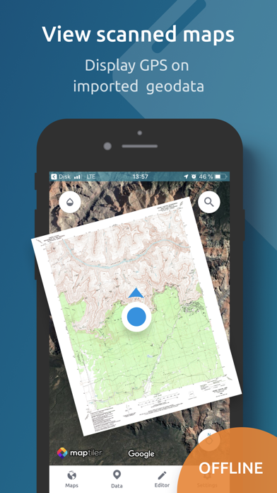
Display offline maps generated with MapTiler (https://www.maptiler.com).
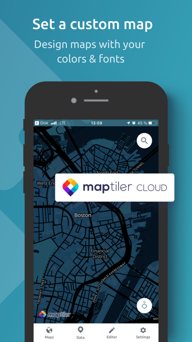
Choose from various basemaps like street and satellite. Preview on a mobile device the map you previously designed with own colors and fonts in MapTiler Cloud.
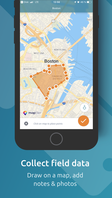
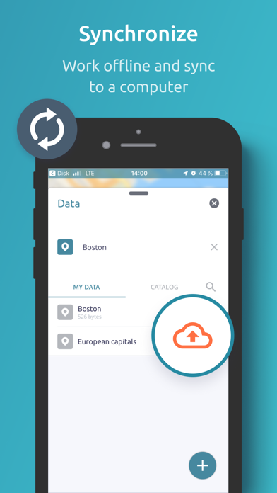
The app supports GeoJSON and MBTiles formats and data synchronization between multiple devices and desktop computer using cloud. I it easy to share the data with other people and collaborate! Perfect for mobile data collection for GIS and surveys.
Import scanned hiking maps, PDF maps, drone aerial imagery, nautical charts for sailing and navigation with a boat or a yacht, fishing maps, aeronautical charts for flight planning by pilots, parcels and city plans and other opendata from local government. OpenStreetMap vector maps are powered by OpenMapTiles project (the successor of OSM2VectorTiles). Maps can come from existing tile servers with OGC WMTS, TileJSON or XYZ tiles from.
Supported geodata formats by MapTiler: GeoTIFF, TIFF, JPEG, ECW, SID / MrSID, NOAA KAP / BSB, DEM, OziExplorer OZI OZF2 & OZFX3, WebP, JP2, JPEG2000, GeoJP2, Erdas, Grass, Safe, Sentinel2, SRTM, NASA imagery, USGS map sheets, exports from ESRI ArcGIS, ArcSDE, etc.
The GeoJSON can be converted from / to: ESRI ShapeFile (SHP), DXF, DWG, GPX, CSV and KML.
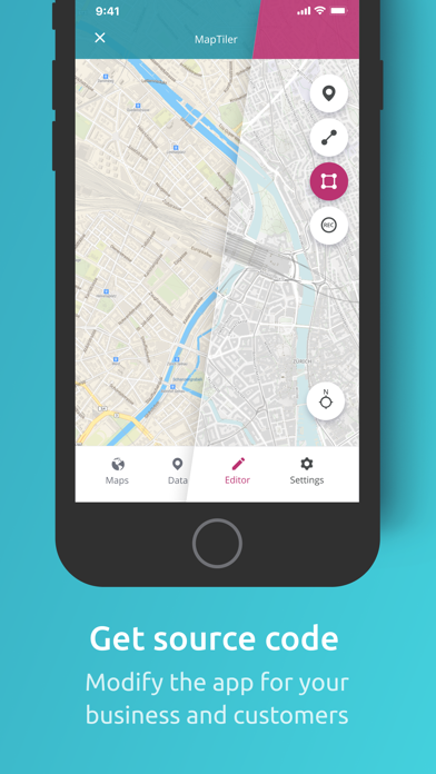
Contact us if you want to use the functionality from this app in a rebranded app for your customers, for your business use-case or for presenting your own maps. We can provide the source code and assist with customization.
Reviews
Amazing!
Cockadoodle-chomp
Incredible functionality clean interface powerful features this app is a home run good job!
Meh
mtb_ogre
Apparently the only way to get files in or out is with a cable or by setting up a Google Drive account. Kind of put the kibosh on this whole thing. Looks like a cool app otherwise but kind of useless as is.
??
This name is taken!!
Kind of useless really nothing you can do with this app. I was expecting it was going to let me create maps on my iPad like I do on the desktop app. We use maptiler to create maps for ForeFlight and that feature is great we were looking for a more mobile version of the app. Waste of 2.99 on the upgrade when you can’t really do anything on this app. I mean even when drawing on the map can’t really change colors on polygons and lines and very limited drawing capabilities specially with the new iPad Pro I was expecting a little more. Ps: importing pdf maps is nightmare, when linked to my drive it only recognizes mbtiles already completed.
Very bad update!!!
Tommy Spike
I saved many fishing spots in the app. With the latest update, all of my saved spots are gone. Very bad. And it will not load the mbtiles files generated by older version of MapTiler Desktop. Why?
DO NOT UPDATE!!!!!
apgfinancial12
Do not update to version 2.0! The app crashes before you can even do anything!!!
Don’t update
Sijitsma
I should have heeded the advice, and not updated. It doesn’t crash for me, but is not possible to load geojson or MBTiles anymore. You can see the files, but aren’t selectable. On the plus side, the interface is better. If you just want a standard background map, works fine for that. Klokantech has been making a big push, but appear to be overdriving their quality, and nothing quite works right. My bug requests have gone unanswered.