Light Pollution Map - Dark Sky
| Category | Price | Seller | Device |
|---|---|---|---|
| Weather | Free | Dunbar Technology, LLC | iPhone, iPad, iPod |
List of all features:
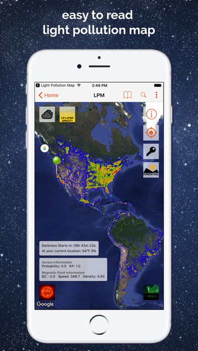
• Highly accurate, customizable and interactive light pollution map to find dark sky viewing locations near you.
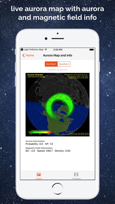
• See live aurora borealis information such as KP value, magnetic field information, and more for the hardcore aurora chaser.
• Live aurora borealis visibility map for northern and southern hemisphere, with additional timelapse options.
• Aurora information widgets (today widget).
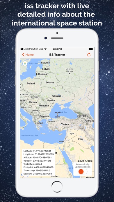
• ISS Tracker with live updates about the international space station including the location, visibility, velocity, altitude, and more.
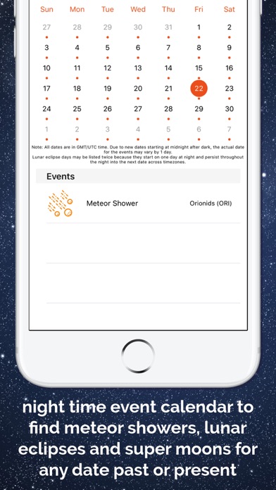
• Night sky event calendar allows you to find dates for lunar eclipses, super moons, and meteor showers.
• Live images of the Sun via NASA's Solar and Heliospheric Observatory.
• Darkness countdown timer until the darkest period of night so you know when the night sky will be the darkest. Also let you know when it starts getting light outside.
• Astronomy photo of the day directly from NASA! A new one every day to look at!
• Local temperature indicator to know if you need to bring a sweater before you even step outside.
• Local cloud coverage indicator to know if you will be able to see anything before you step outside.
• Cloud cover overlay on the main map to find clear sky locations at night.
• Settings to customize the app.
• Moon information such as moon phase, moon rise, and moon set times, days of next full moon and new moon, etc.
• Moon direction tool which allows you to find where the moon will be, at any time, any date, for any location.
• Enable a horizon safe radius circle to avoid light pollution from nearby cities on the map.
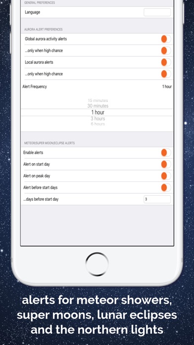
• Local Aurora Borealis (Northern/Southern Lights) alerts and push notifications.
• Global Aurora Borealis Activity alerts and push notifications.
• Meteor shower alerts and push notifications.
• Super moon alerts and push notifications.
• Lunar eclipse alerts and push notifications.
• Save and load your favorite dark sky locations.
• Navigate to your saved locations using the Apple Maps app.
Some features above require an optional in-app purchase to upgrade to the pro version. Every purchase helps us to continue running and developing the app and is much appreciated.
Note: Light Pollution Map loads data online. Internet connection or wifi is required, and we are not responsible for any data usage chargers from your provider.
Reviews
Great app
Missaliciakay
Easy to use and user friendly. Love that you can see the light pollution and its effect in star viewing
Useful tool for photographers
Gabie Rose
This is a perfect app for photographers who want to shoot long exposure shots. This tool helps find places that are not over populated with light. You'll find the best places to get the perfect galaxy photos.
Pretty much useless unless you upgrade
HeliGal
No data available at any zoom level I tried. Why don't they just sell it for $1.99 and skip the upgrade. Waste of time.
Pro version - Not bad, if only LP info loads faster
Azstrgzr
The light pollution overlay takes forever to load. Very slow. Rather disappointing.
After a response from the developer
keltoii
Update: I actually received an update from the developer with hopes of lots of new features including zoom for the free version. I can definitely get behind that. Looking forward to seeing the full potential of the app! Useless for zooming in for any sort of detail outside of an entire state view unless you upgrade to pro...