AgriGPS
| Category | Price | Seller | Device |
|---|---|---|---|
| Utilities | $19.99 | Bertrand BLOND | iPhone, iPad, iPod |


Farmer, surveyor, manager of land hunting, use your iPhone to measure your area and land.
FInd directly surface/area in hectares, m2 etc. ... your agricultural parcels, timber, hunting plan, forest, pond etc..
Simple: walk around your land, save the GPS points, save them in real time and export them directly to your computer with the format KLM G. Earth (rotation map for hunting, perimeter, etc. ...).
This tool can also be a considerable help to the establishment of the CAP such statement or audit of agricultural land.
CAUTION: This application is a tool for measuring surface, it does not guarantee the veracity of this one, the measurement made with AgriGPS will have no legal value in case of control.
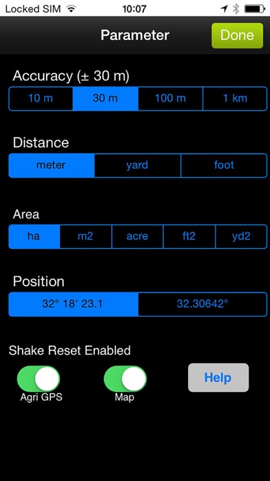
The accuracy depends on the quality of GPS signal you during the measurement, it is advisable to start the application 5-10 minutes before you start making the point, and remain motionless for 30 seconds at each point.
Location-based GPS is the GPS will be more accurate remaining motionless for a moment to take a point.