Agremo: Drone Map Analysis
| Category | Price | Seller | Device |
|---|---|---|---|
| Business | Free | Agremo doo | iPhone, iPad, iPod |


Agremo analyses are requested by uploading a drone map to the Agremo web app or the Agremo app on DroneDeploy and the analysis report & result are easy to understand and provide actionable information.
The algorithms that stand behind the Agremo app have been developed in close collaborations with academic institutions and remote sensing experts. To assure a high level of accuracy, Agremo's algorithms take multiple factors into account and go beyond mere NDVI insights. Another big plus is that every report is reviewed by internal ag experts prior to sending it to you.
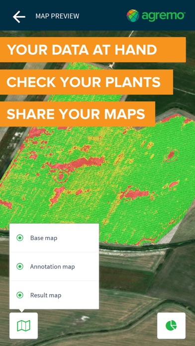
Agremo mobile app is an additional tool which will improve your user experience. Besides allowing you to have a quick access to your maps and reports, the mobile app will allow you to navigate through your field. Analyze your fields with Agremo, and easily visit the identified stress zones or marks of interest.
Agremo analyses:
• Stand Count
• Plant Population
• Plant Stress Analysis
• Weed Analysis
• Pest Analysis
• Plant Disease Analysis
• Water Stress Analysis
• Flowering Analysis
• Eagle Eye Report
• Yield Potential
• Arable Area
• Yield Calculator
• Elevation
www.agremo.com