AeroPlus Aviation Weather
| Category | Price | Seller | Device |
|---|---|---|---|
| Weather | Free | Bright55 B.V. | iPhone, iPad, iPod |


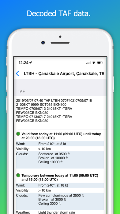
The app presents pilots with the well known METAR and TAF data in an intuitive and visual way.
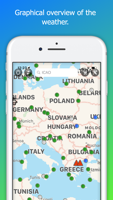
Scroll over the map to the area you are interested in and get a good overview of the expected weather in that area in a visual way. Zoom into advanced features after that for a more detailed weather analysis.
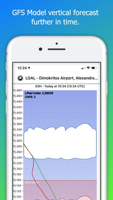
This app provides pilots with often hard to find information such where to expect the top-of-clouds, severe turbulence, convective activity, freezing levels, temperatures and dew points at the flight levels and the expected winds aloft.
We added a simplified but powerful Clouds Diagram showing you where to expect cloud layers, type of clouds (turbulence and convective energy) and where to expect the freezing level and the most dangerous areas for aircraft icing.
Additionally, we added direct links to the most important significant weather charts in our app, so that you have all the information you need at your fingertips to make a good analysis of the weather en route to your destination.
Finally, use our app in combination with the Iridium GO! satellite hotspot device to get the latest rain radar, lightning and airport data while you are in-flight.
Reviews
I have seen better
MattDux
On an iPhone 4, the app is slow and uses google maps as a base layer. TAF coverage is an in-app purchase. There are others that are better.
Awesome
Brainal
Really nice app. Worth 3-4 dollars. Love the world-wide coverage. No app out their fills this niche, and for free, too good. I would like to see temp added as one of the displayed variables. Keep up the good work. If anybody finds a better app, list it. Oth
mind-numbingly slow
flitetym
Jeez ... 'ya ever watch paint dry? Somebody dosen't know how to code software ...
not a bad start....
cwbyflyer
THe interface is great looking and I had high hopes. However, there are a lot of missing airports (the smaller ones) and since I'm a private pilot, those are the ones I really need. There does not appear to be a way for me to add airports to the database either
Great app missing a few things
D-iphone
App is due for an update as it has been a while. Over all good app would love to see radar over lay. How about forecasted icing or thunderstorms like the HEMS site does? a little faster loading of the TAF would be helpful.
Good app
Note
Good app for pilots who want stuff fast and easy. Should still have the type of flight recommended though. (vfr,ifr, etc.)