Mapswipe
| Category | Price | Seller | Device |
|---|---|---|---|
| Utilities | Free | Whitespell, LLC | iPhone, iPad, iPod |
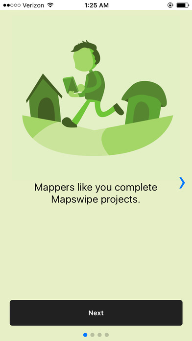


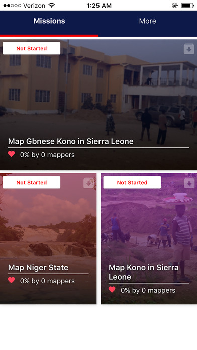
MapSwipe, developed in collaboration with the Missing Maps Project, allows users to remotely contribute to humanitarian missions. Users choose a task in a crisis prone part of the world, such as spotting villages at risk of a cholera outbreak in the Democratic Republic of Congo, for example, and swipe through satellite images of the region, tapping the screen to mark the location of settlements, roads, rivers, and other features.
This information is fed back to mappers who use it to build detailed maps that can be used in the field. At present, these mappers must spend days scrolling through thousands of images of uninhabited forest or scrubland in search of small, far-flung communities. With MapSwipe, members of the public can donate their time to organizations like Médecins Sans Frontières and the Red Cross, expediting the arduous process of locating the people who need their help. With this generous contribution from users like you, mappers – and ultimately medical professionals on the ground – can get straight to work.
Reviews
iPad Functionality is missing
Hajdinak
Love the app and the cause, the app is simple and quick to pickup. Would like to see more optimization for the iPad or a potential standalone app with greater tools and functionality.
Great Idea and Execution
ThePapercutNinja
This is a really cool app, it’s good to use when you’ve got some time to sit or are just hanging out. It doesn’t need a very strong connection or a powerful phone to work, and looking for buildings on it gets kind of addicting! It’s an awesome idea to crowdsource this kind of stuff, and the app functions perfectly. It’s simple and easy and has a good tutorial, so you should at least give it a try.
Great app. Need more guidance
rider in brooklyn
This is really fulfilling an important need. I would like more guidance on what is the shadow of a tree and what is a round building. Thank you!
Love Idea, Small Bugs
BlindUser1968
This is an awesome idea! There are some lingering bugs tho. If you adjust the iPhone text size in settings, part of the text in the app flows off of the screen and makes it unreadable. Keep up the good work!
Good feel good app
iolaire
Simple app, look at arial photos and tap once if it has the desired features, can be home/hut, roads or "tracks" depending on the tasks, tap twice for a maybe or three times for bad image. So very simple. I would like better definitions of a "track" since I think that means a path, so lots of paths show up which could be animal tracks or maybe even stream beds. I worry I'm flagging too many tracks. I think it would be good to have a gallery of normal objects. I'm sure someone is highly skilled at this task already and could provide examples of say six hut styles to help make sure we know what the look like.
v1.1.0 does NOT work
what8ever
8/12/2016 v1.1.0 still does NOT work. Same as reported on 7/15/2016. 7/15/2016 v1.0 does NOT work. Tap the app icon, get black screen, and then it quits. iOS 7.1.2 on both iPhone and iPad. Sent feedback but no response.