
iGIS
| Category | Price | Seller | Device |
|---|---|---|---|
| Business | Free | Geometry | iPhone, iPad, iPod |


True GIS functionality is now available on the iPhone! Your iPhone. Your data. Your maps.
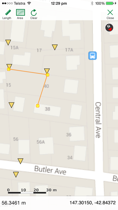
iGIS represents a new era in mobile GIS solutions by enabling users to load, view, investigate, create and export their own data over a background of map service imagery.
Importing data is easy with our unique data import facility using the USB cable or wirelessly on your Mac, PC and Linux. Raster data in many formats (pre-processing required) and ESRI Shapefiles (.shp) are supported at the moment.
Your spatial data is stored on the iPhone, so there’s no need for an Internet connection to see your data – great for field work. We also support over 3000 projections, so no need for re-projection.
We include support for multiple layers of points, lines, and polygons – all styled as you like. Imagery layers too in V5.
Add comments to your maps - A point layer is added with a name and description field.
Add and edit your own layers, via the map display and customisable data entry forms.
Export your layers to ESRI shapefiles for use back in your enterprise.
Other features include:
- Great speed, using our multi-threaded map renderer.
- Support for large datasets.
- Import and export of ESRI Shapefiles.
- Display current GPS location in your chosen projection ( + compass)
- Zoom to current location
- Zoom to data extent
- Map Pan, zoom in, zoom out
- Changeable drawing styles for a layer: size, color, transparency
- Set the draw order and visibility of map layers
- Set the zoom scale for layers via a simple slider
- Select and interrogate feature attributes via point and click
This application is designed for GIS professionals and an understanding of some basic GIS concepts such as layers, shapefiles, projections etc, would make using iGIS simpler. Please let us know if concepts in iGIS are unclear.
Continued use of GPS running in the background can dramatically decrease battery life.
Reviews
Great start
bigJ77
The import works great and I am able to put very large amounts of data on the map. I have not been able to get the export to work. Nothing shows up in the list. The app needs some enhancements but a very good first version.
Great for field vertification.
Rayadoman
Good GIS program for field vertification. I like that I can take 400 MB with of shapefiles and view them in the field. Wish they would add the ability to import custom imagery instead of depending on Google. I have encountered a couple of bugs that crash the software. In addition, I can't get any features symbology to be brown. Always converts it to yellow. Other than that, great tool for my iTouch.
Did anybody bother to test this thing?
PentagonDeskJockey
Don't get me wrong, I like the basic idea, which is why I coughed up $20, but did anybody bother to test this thing? It's completely unusable -- it crashes at every corner. I can't believe they have the gall to even put this up for sale! Fix it, and I'll revise my opinion, but for now this is a big fat THUMBS DOWN. And I'm asking Apple for my money back.
Not so good.....
DG surveyor
I am a professional land surveyor and has high hopes for this application. This software is presently just shy of junk. Amazing when it works but it rarely does especially with larger datasets. Crashes OFTEN. I would like my money back. Twenty dollars is a lot of money for this piece of shoddy programming.
Getting better
debbieh2283
Wow, I must of been lucky. Mostly it works for me. Yes it does crash once in a while and for some reason it will not import 3 of my layers but other than that it keeps getting better after every revision. All my attribute data shows up perfect.
Do not buy this
lowerliquid
Very buggy and most importantly- it does not work. All of my info loads in, but displays nothing and provides none of the attribute info that comes with my shape file. I payed $40.00 bucks for this and thus far (3 days ), I have not received any feedback. ---------2nd review after version 2.0 released. Beware!!! This is a review for the igeometry GIS app. Please note this review is based on extensive evaluations of both versions. First let's start with the obvious- the software does not work with my shape file. That being said, the installation of shape file went fairly effortlessly, and all of my attributes loaded in correctly. Although the attributes loaded in, none of the data did. NOTHING! To charge 40 bucks for this and not have anything work is most bothersome and remains the single most app ripoff that I have purchased so far. Emailing for support has been a waste of time, with no feedback from the developers. I Use ARCVIEW at work so I know the file is a good one, and since everything loaded in correctly, with no error messages, the files are definitely not the problem. Do not buy this software unless they offer a free version first. Paul Turner
Updates Now make it 5 stars
AKChad
This is a great GIS application. I reviewed the first version of this App and only gave it three stars. Since then they have fixed the issues and added the great thematic coloring feature. In addition, they have been very responsive to my critiques and suggested modifications. It is a relief to deal with such a responsive company. I highly recommend this application.
Good basic GIS viewer
Geogrfy
Waited until ver 2.1. Only issue I have is loading shp files with multi-part polygons (multiple polygons with a single attribute record). This is a typical issue when using Google Maps. Like the app. Keep adding more features...
Finally GIS on the iPhone
Makisupa7
Just bought this app a couple days ago. I've imported a few shapefiles from work and they all have worked so far. I have a few suggestions. Work on symbology for multiple categories in each shapefiles. Allowing imports of layers would help with this. A more intuitive table of contents for layer adjustment, toggling and symbolism would be great. Create a toolbar for Id, measure, area, and selection. An option for attribute selection and export of selection as shp would be ideal. A toolbar with some simple analysis tools such as buffer, union, and intersect would make this a more practical program. Also, last but not least an editor feature that allows for polygon and line editing and feature creation as well as attrribute field editing would be awesome. This is a lot to ask for in a handheld GIS app, but I am looking forward to new updates. So far I'm quite impressed with this. You can't beat it for $20!!
A work in progress that is well worth the money
lavalampfloyd
For anyone who has GIS data they would like to display on an iphone this is the app. Their data upload is very slick. Initially I had difficulty getting the projection that we use at work to execute, but the support was very responsive and I was able to get it going in short order. For those who use WGS84, you will have no difficulties. Since I bought it there have been several good updates and the developers seem to be actively upgrading the app. Hopefully they will continue to add more options for symbology and labeling. Some of the earlier comments indicate difficulty with exported shapefiles and the like. I too ran into a problem with one shapefile, but I sent it to the developer and they found the problem and updated the app. (FYI: I work on a water distribution system and the program easily handled 14 different point and line shapefile sets, each with 1,000 to 6,000 features (I did use zoom levels to help with performance.))